History of the Big Pines Recreation Area

Origins in the 1920s: Vision and Creation of an All-Year Playground

Big Pines Recreation Area was conceived around 1920 when Los Angeles County Supervisor R. F. McClellan promoted the idea of creating a grand alpine park at the county’s northeast edge. The County began acquiring land in the Swarthout Valley, including Big Pines Ranch, eventually securing nearly 4,000–5,600 acres by 1924. Construction started in 1923 with help from county jail work crews. Access was initially limited to routes through Palmdale or Lone Pine Canyon; a direct road from the Los Angeles basin would not arrive until the Angeles Crest Highway reached Big Pines in 1956.

The park officially opened in August 1924. Its centerpiece was the Community House (Recreation Hall), a rustic lodge with high wood beams, large stone fireplaces, and amenities like a reading room and store. The Swarthout Valley Lodge, completed in 1925–26, added dining, a soda fountain, and a post office, and later served as Forest Service offices. A 35-acre lake provided swimming in summer and ice-skating in winter, while over 100 stone stoves and picnic tables dotted the grounds. By the late 1920s, numerous clubs and youth groups had built permanent camps at Big Pines.

The most iconic structure was the Davidson Arch, a massive stone gateway dedicated in 1926, featuring a footbridge on top and castellated towers on each side of the road. Big Pines quickly became a destination for both summer and winter recreation. It hosted activities such as fishing, camping, and hiking in the warm months, and skiing, tobogganing, and ski jumping in the winter. In 1929, the world’s most significant ski jump was built there, briefly making Big Pines a contender for the 1932 Winter Olympics.

A political scandal erupted in 1926 when the county district attorney accused supervisors of misusing Big Pines for personal benefit, but charges were dismissed. Despite the controversy, the park thrived as Los Angeles County’s showcase alpine playground.

The 1930s: Winter Sports Boom and Depression-Era Challenges

The 1930s saw the addition of the first rope tows on Table Mountain and the Blue Ridge ski area, making Big Pines a hub of winter sports. State championships and ski jump competitions drew national attention. Yet the Great Depression strained county finances, making the park expensive to maintain. Some facilities closed or were scaled back, though skiing remained popular because it was relatively affordable.

By the late 1930s, the County began negotiations to transfer Big Pines to the U.S. Forest Service, viewing federal management as more sustainable. Plans for a land swap with the federal government were under discussion by 1940.

The 1940s: World War II and Transition to the Forest Service

During World War II, gasoline rationing and reduced travel led to fewer visitors. Services were scaled back, but the park remained open. In July 1941, the Forest Service began operating Big Pines, though legal complications delayed the formal transfer until 1946. At that point, the recreation area became part of Angeles National Forest. The Swarthout Lodge became the Big Pines Ranger Station, while the Recreation Hall served as a visitor and community center.

Mid-20th Century (1950s–1970s): New Roads, Resorts, and Scientific Outposts

The completion of the Angeles Crest Highway in 1956 made Big Pines easily accessible from Los Angeles. The Forest Service improved campgrounds, picnic areas, and trails, including segments of the Pacific Crest Trail. Skiing expanded into three areas: Blue Ridge, Holiday Hill (opened 1949), and the Table Mountain site (later Ski Sunrise). These evolved into Mountain High Resort, one of Southern California’s most popular ski destinations.

In 1924 the Smithsonian had established a research station on Table Mountain, which NASA’s Jet Propulsion Laboratory took over in 1962. The Table Mountain Observatory became an important site for astronomical and atmospheric research.

Some historic structures changed during this period. The Davidson Arch was partially dismantled in 1950, leaving only the north tower. The tower was once used to hold unruly guests in a makeshift jail cell. The Swarthout Lodge continued in use until the 1980s.

Late 20th Century: Preservation, Fire, and Modern Recreation

In 1987, arson destroyed the Swarthout Lodge, which at the time housed ranger offices and historic archives. This loss highlighted the need for preservation. The Recreation Hall and the surviving Davidson Arch tower remain as historic landmarks. Efforts since then have sought to preserve and interpret Big Pines’ history. In 2006, the area was nominated as a Historic District, and in 2014, it became part of the San Gabriel Mountains National Monument.

Today, Big Pines offers camping, hiking, fishing, skiing, and snowboarding. The Mountain High Resort dominates winter activity, while summer visitors enjoy campgrounds and trails. The Recreation Hall now serves as an information station, and interpretive signs explain the area’s rich past. Big Pines continues to embody its original vision: an all-year playground where city dwellers can find alpine recreation just a short drive from Los Angeles.


References

Homestead Museum Blog – Big Pines history (2018)
https://homesteadmuseum.blog/2018/01/15/at-our-leisure-big-pines-recreation-camp-angeles-national-forest-late-1920s/

Homestead Museum Blog – Remnants of Big Pines (2018)
https://homesteadmuseum.blog/2018/08/23/discovering-remnants-of-big-pines-recreation-camp/

Swarthout Family History – Big Pines history and lodge details
https://www.swarthoutfamily.org/History/CABigPines.htm

Angeles Crest Scenic Highway – Big Pines recreation info
https://angelescrestscenichighway.com/big-pines.html

U.S. Forest Service – Big Pines Visitor Center
https://www.fs.usda.gov/r05/angeles/recreation/big-pines-visitor-center

Wikipedia – Mountain High Resort history
https://en.wikipedia.org/wiki/Mountain_High

Wikipedia – Table Mountain Observatory (Wrightwood, CA)
https://en.wikipedia.org/wiki/Table_Mountain_Observatory

Within the Panorama (Creley) – Davidson Arch and history
http://www.wrightwoodcalif.com/panorama/panorama_arch.html

San Gabriel Mountains National Monument Plan – Cultural resources
https://www.fs.usda.gov/detailfull/r5/landmanagement/planning/?cid=stelprdb5410677

History of California State Highway 2 – The Angeles Crest Scenic Route

Early Planning and Purpose (1900s–1920s)

The idea for the Angeles Crest Highway emerged in the early 20th century as Los Angeles expanded. Local boosters envisioned a road to open the San Gabriel Mountains for motorists and provide better access for fire control. In 1919, survey work began, led by engineer J.B. Lippincott. The proposed route followed high ridges with a maximum grade of about 6.5% and broad, sweeping curves. It was intended to provide city residents with access to alpine scenery while enabling fire crews to reach remote areas.

Construction of the Highway (1929–1956)

Construction began in 1929 under the California Division of Highways with the U.S. Bureau of Public Roads. Work stretched across 27 years, interrupted only by World War II. Laborers included unemployed men, Civilian Conservation Corps teams, and prison inmates from San Quentin and Chino. Crews blasted through granite, carved cuts up to 240 feet deep, and built bridges across gullies. Near Islip Saddle, two tunnels were excavated to carry the road through high ridges. The road reaches its highest point at Dawson Saddle (7,901 feet).

By 1932, the first segment opened from La Cañada Flintridge to Red Box Saddle, drawing millions of visitors in a short time. This shift in access transformed mountain recreation from hiking to automobile tourism. After decades of incremental progress, the final segment to Big Pines and Wrightwood opened in 1956, completing the 66-mile route.

Mid-Century Developments and Scenic Recognition (1957–1970s)

Once completed, the road quickly became popular but faced constant threats from landslides and erosion. In 1971, the Angeles Crest Highway was designated a California State Scenic Highway, covering 55 miles from La Cañada to the county line. Though briefly included in the state freeway plan in 1959, it was removed in 1978.

That same year, a massive landslide destroyed the connection between State Route 2 and State Route 39 near Islip Saddle. The damage was never repaired, ending the dream of a continuous scenic loop through the San Gabriels.

Scenic Byway Designation and Ongoing Challenges (1980s–2000s)

In 1990, the federal government designated the route a National Forest Scenic Byway, recognizing its national importance. By then, the highway had become both a popular drive and a hotspot for motorcycle accidents, prompting safety crackdowns.

Wildfires and storms caused repeated damage. The 2009 Station Fire burned vast stretches of forest, followed by heavy rains in 2010 that washed away road sections. The road remained closed for nearly two years, reopening in June 2011 after major repairs.

Recent Events and Repairs (2010s–2025)

Caltrans has continued upgrades, including resurfacing and safety improvements. Yet the cycle of damage and repair persists—the Bobcat Fire in 2020 and the Bridge Fire in 2024 forced closures. Severe storms in 2022–23 caused major washouts between Islip Saddle and Vincent Gulch, requiring a multi-year, multimillion-dollar rebuild.

In August 2025, Caltrans reopened the full highway after more than two years of partial closure. Travelers can once again drive from La Cañada to Wrightwood, though closures remain an ongoing reality in this unstable mountain environment.

Cultural and Scenic Importance

The Angeles Crest Highway transformed recreation in Los Angeles, bringing millions into the mountains by car and ending the isolation of resorts once reachable only by trail. Roadhouses like Newcomb’s Ranch became iconic gathering places. The road is also well-known in popular culture, having appeared in numerous car commercials and films.

Its state and national scenic designations ensure that development along the corridor is limited to preserve views. Despite dangers from sharp curves, steep drop-offs, and sudden weather, the route remains one of California’s most beloved mountain drives.

Dual timeline showing both the historical/social milestones and the engineering/construction milestones of the Angeles Crest Scenic Route (State Highway 2).


Historical and Social Milestones
1900s–1910s – Local boosters push for a mountain road to open the San Gabriels for tourism and firefighting.
1919 – J.B. Lippincott surveys a high-ridge route for the Automobile Club of Southern California.
1929 – Construction begins under the Division of Highways.
1932 – First section opens to Red Box Saddle; hiking culture gives way to car tourism.
1930s – CCC crews and prison inmates contribute to construction.
1941–1945 – Work halts during World War II.
1956 – Full 66-mile route opens to Big Pines and Wrightwood.
1971 – Officially designated a California State Scenic Highway.
1978 – Landslide severs SR-2 and SR-39 connection; never restored.
1990 – Designated a National Forest Scenic Byway.
2009–2011 – Station Fire and storms destroy sections; road reopens after $32 million repair.
2020 – Bobcat Fire causes closures.
2022–2023 – Historic storms wash out major segments.
2025 – Full highway reopens after $7.9 million rebuild.

Engineering and Construction Milestones
1919 – Survey establishes a route with ≤6.5% grades and 300-foot-radius curves for safe mountain driving.
1929 – Initial grading begins near La Cañada; crews use hand tools, dynamite, and heavy machinery.
1930s – Road cuts as deep as 240 feet carved into mountainsides; bridges built across gullies.
1930s–1940s – Prison labor camps established; inmates from San Quentin and Chino work alongside contractors.
Late 1940s – Twin tunnels bored near Islip Saddle (680 ft and 470 ft long).
1950s – Dawson Saddle reached at 7,901 ft – the highest highway pass in the San Gabriels.
1956 – Last segment tied together; route spans 66 miles from La Cañada to Wrightwood.
1978 – Landslide permanently removes SR-39 connection.
2009–2011 – Culverts, retaining walls, and roadbeds were rebuilt after the Station Fire and debris flows.
2022–2025 – Major slope stabilization, drainage replacements, and retaining wall construction along Islip Saddle–Vincent Gulch.


History of Table Mountain Ski Lodge and Ski Sunrise, Wrightwood, California

Early Development and Big Pines Origins (1920s–1930s)
Skiing in Wrightwood grew out of the Big Pines Recreation Area, developed by Los Angeles County in the 1920s. By 1929, a massive ski jump was built for winter carnivals, and Table Mountain soon became recognized as a prime slope. In 1937, Harlow “Buzz” Dormer and Craig Wilson installed the first rope tow on Table Mountain. Dormer formalized operations in 1939 when he obtained a Forest Service permit and built a small warming hut. This made Table Mountain one of the earliest formal ski areas in Southern California.

The Howard Moore Era (1940s–1960s)
Howard “Bud” Moore took over in 1943 and secured a long-term permit in 1945. By the early 1950s, Moore constructed a two-story lodge at the base of Table Mountain using timber milled on-site. The resort grew steadily, adding several Poma lifts during the 1950s and 60s, including the formidable “Giant Poma.” Moore was known for his innovations: providing standardized snow reports, advocating ski safety rules, and experimenting with snowmaking despite water shortages. The resort gained popularity among families for its rustic charm and accessible terrain.

Transition to Ski Sunrise (1970s)
After a crippling accident in 1969 left Moore partially paralyzed, he sold the ski area in 1972. In 1973, a group of investors under Tamount, Inc., took over. By the 1974–75 season, they rebranded the resort as Ski Sunrise. Improvements included a chairlift, a new restaurant, snowmaking enhancements, and expanded facilities. Ski Sunrise marketed itself on its uncrowded slopes and sunny exposures, attracting skiers looking for a quieter experience. In the late 1990s, it also opened the Sky High disc golf course, still active today.

Challenges and Decline (1990s–2004)
Ownership returned to Moore in 1993 when the investors defaulted. Although he continued to run Ski Sunrise, drought winters and competition from Mountain High devastated attendance. In 1999–2000, the area operated for only 35 days across two seasons. With limited snowmaking and shrinking skier visits, Ski Sunrise could not compete with larger, better-funded resorts. In 2004, Mountain High purchased the property, ending its independent ski operations.

Legacy and Current Status
Howard Moore, remembered as a pioneer of Southern California skiing, died in 2006. Today, the old Ski Sunrise area is Mountain High North, used primarily for tubing, snow play, and beginner lessons. The original lodge, built in the 1950s, still stands, serving guests in winter. The Sky High Disc Golf Course continues as a summer attraction. Though the Ski Sunrise name is gone, the mountain remains a cornerstone of Wrightwood’s ski history, remembered fondly by generations of skiers.


Timeline

1924 – Big Pines Recreation Area opens, developed by Los Angeles County as a mountain retreat.

1929 – A 1,150-foot ski jump is built in Big Pines, drawing attention to the area for winter sports.

1937 – Harlow “Buzz” Dormer and Craig Wilson install the first rope tow on Table Mountain.

1939 – Dormer receives a Forest Service permit and builds a warming hut, formally establishing Table Mountain Ski Area.

1943 – Howard “Bud” Moore takes over operations of Table Mountain Ski Area.

1945 – Moore secures a Forest Service permit for ownership and long-term operation.

Early 1950s – Moore constructs a two-story base lodge from timber milled on-site.

Mid-1950s – Several Poma lifts are installed, including the “Giant Poma.”

1969 – Moore suffers a serious accident, leaving him partially paralyzed.

1972 – Moore sells the ski area to Tamount, Inc.

1974–75 – Resort is renamed Ski Sunrise. New ownership adds a chairlift, restaurant, and snowmaking upgrades.

1980s–1990s – Ski Sunrise maintains a niche following with uncrowded slopes and family-friendly atmosphere.

1993 – Tamount defaults; Howard Moore forecloses and regains ownership.

1999–2000 – Severe drought limits operations to just 35 days across two seasons. Skier visits drop drastically.

2004 – Mountain High purchases Ski Sunrise for about $375,000, converting it into a snow-play and beginner area.

2006 – Howard “Bud” Moore passes away at age 91.

Present – The area is operated as Mountain High North. The original lodge still stands. In summer, the Sky High Disc Golf Course remains popular.

More than a Store

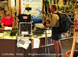
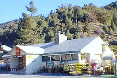
Mountain Hardware in Wrightwood, California, is more than just a store—it’s a vital resource for residents and visitors navigating life in a mountain village. In a place where the nearest big-box stores are miles away, having a full-service hardware store stocked with essentials like power tools, winter gear, gardening supplies, and hiking equipment is crucial.

60th anniversary celebration

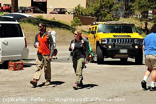
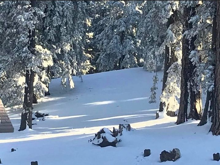
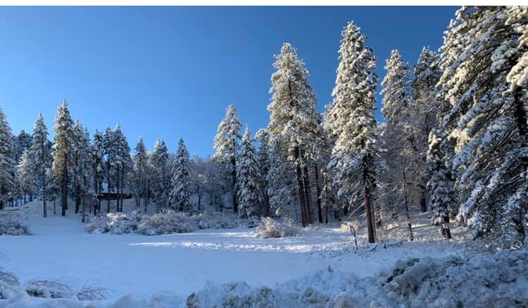
Wrightwood, nestled in the San Gabriel Mountains along the Angeles Crest Highway, experiences all four seasons, including heavy winter snowfall. Residents and weekend visitors rely on Mountain Hardware for tire chains, snow play gear, and cold-weather clothing. During warmer months, the store provides backpacking and hiking supplies for those exploring the Pacific Crest Trail or the many scenic trails around town.

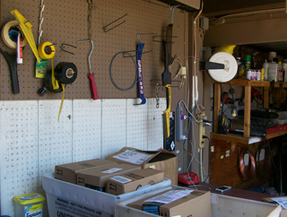
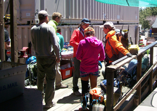
Beyond seasonal necessities, Mountain Hardware is a lifeline for home maintenance and emergency repairs. When a snowstorm rolls in, locals can’t afford to drive long distances for supplies—they need shovels, generators, and propane close at hand. The store’s rental equipment, from tools to outdoor gear, adds another layer of convenience.

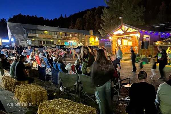
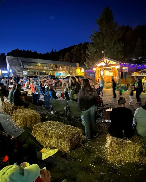
For a small mountain community, a well-stocked hardware store is more than a place to shop; it’s a hub of self-sufficiency. Whether locals are prepping for a storm, weekenders are gearing up for an adventure, or DIYers are tackling home projects, Mountain Hardware is an essential part of Wrightwood’s rugged, independent lifestyle.

PCT Wrightwood

Mountain Hardware: A Vital Resupply and Support Hub for Pacific Crest Trail Hikers

Mountain Hardware is a store and more in the California mountain town of Wrightwood; it helps Pacific Crest Trail hikers. Located close to mile 364 of the 2,650-mile trail, the store is an easy resupply point and a friendly pit stop for weary hikers traveling through the rugged San Gabriel Mountains.

Mountain Hardware is not just any hardware store. It sells tools, building supplies, and outdoor gear to the locals, but it is also renowned as a top stop for PCT hikers. The store stocks vital gear, trail maps, and necessities like fuel canisters, water purification tablets, and energy-rich snacks. Hikers who come in with broken trekking poles, worn-out gear, or missing pieces of equipment typically find what they need on the store’s shelves.

One of the useful services offered by Mountain Hardware is a safe zone for mail drops. Many PCT hikers send resupply packages to points along the trail, and Mountain Hardware offers a safe place to accept and hold these packages. This service is very helpful since Wrightwood is hard to reach without help, and hikers rely on their mailed supplies to move forward.

Additionally, Mountain Hardware is where hikers catch rides into town. The store also functions as an unofficial information stop where trail angels—local people who give rides, lodging, and help—connect with hikers who need help. Wrightwood’s charitable community is renowned for its kindness, and Mountain Hardware helps make such connections possible.

Mountain Hardware has a PCT trail register. Hikers sign their names, leave messages about the trail, and write notes to other travelers. The registers are an important part of the PCT tradition. They allow hikers to stay connected, traveling north or south, even if they meet briefly. The store makes the area inviting by providing a small seating section. Hikers can rest, refuel, and chat with residents who typically want to hear about their adventures.

Mountain Hardware is not just a backpacker shop; it embodies Wrightwood’s friendly character. The locals are knowledgeable about the trails and can recommend where to stay. They also help backpackers find essential spots like the post office, grocery store, and restaurants. Their hospitality and love for the PCT family make Wrightwood a special destination for most travelers.

Mountain Hardware is not merely a regular shop for thru-hikers along the PCT. It is a crucial break point where thru-hikers may resupply, find advice, and feel in their element during their long and often solitary endeavor. For backpackers walking through the wilderness of Southern California, the store illustrates the kindness and support that are part of the PCT culture. It ensures that all the backpackers who stop in Wrightwood are slightly more substantial and better equipped for the trail ahead.

=-

Old Time Hardware Stores

Hardware stores were integral to the fabric of towns, especially from the 19th century onwards, but they evolved considerably due to the Industrial Revolution. This era catalyzed the mass production of hardware items, allowing for the creation of dedicated shops that specialized in tools, building materials, and other hardware products. Previously, these items were typically available at general stores or from craftsmen such as blacksmiths or carpenters who directly sold their handmade tools and metal implements.

The term “hardware store” refers to establishments selling hardware. Initially, this meant ironmongery—the production and sale of goods made of iron. This definition has since broadened to include various products made from multiple materials.

As towns developed and populations increased, hardware stores became more than retail spaces. Particularly in rural or developing areas, these stores served as communal hubs where people exchanged news, conducted business, and accessed essential goods. They were crucial in supporting local infrastructure and agricultural activities, providing the necessary tools and materials for building and maintenance.

Store owners and employees often possess extensive knowledge about the practical applications of their products, making them valuable resources for construction advice and problem-solving. This expertise and their role in community engagement made hardware stores central to towns’ economic and social development.

In the 20th century, the rise of DIY culture and suburban development further propelled the importance of hardware stores. Chains and later big box retailers expanded the scope and scale of hardware retail, catering to professionals and DIY enthusiasts with a wide range of products.

Overall, the hardware store’s evolution from an essential provider of tools and materials to a community cornerstone and large-scale retail operation reflects its enduring significance in society.

Pacific Crest Trail – Wrightwood, CA.

The Pacific Crest Trail (PCT) section, which passes through the Angeles National Forest near Wrightwood, California, offers a remarkable experience for hikers. This part of the trail showcases the diverse landscapes characteristic of Southern California’s mountains, with scenic vistas, dense forest sections, and the unique flora and fauna of the region.

The PCT weaves through elevations that can range significantly in this area, providing varying climates and ecosystems. Hikers can expect to traverse areas dense with pine forests and mountainous terrains with expansive views over the valleys below. The trail also passes near several notable points, such as Mount Baden-Powell, a popular spot for day hikers and long-distance trekkers on the PCT.

The climate in this region can be quite varied; summers are typically warm and dry, making it a popular time for hiking, while winters can see substantial snowfall, especially at higher elevations, adding a challenge for winter hikers or those starting early in the hiking season.

This segment of the PCT is also notable for its accessibility from nearby urban areas like Los Angeles, making it a convenient starting point or resupply spot for those undertaking longer sections of the trail. Wrightwood is a friendly mountain town where hikers often stop to restock supplies, enjoy local hospitality, or take a short break from the trail.

Mountain Hardware in Wrightwood celebrates its 60th Anniversary

Mountain Hardware is a store located in Wrightwood, California. It is a small community nestled in the San Gabriel Mountains. Wrightwood is known for its picturesque landscapes, offering breathtaking views of the surrounding mountains and forests.

The town of Wrightwood is a popular destination for outdoor enthusiasts, attracting hikers, mountain bikers, and nature lovers from all over. The area is home to several hiking trails, including the Pacific Crest Trail, which runs through the town. In addition to its natural beauty, Wrightwood offers a charming downtown area with shops, restaurants, and galleries. Visitors can explore the local boutiques and art studios, showcasing the talent and creativity of the community.

One of the main attractions in Wrightwood is the Mountain Hardware store. Located in the heart of town, this outdoor equipment and gear store caters to the needs of adventure seekers. Whether you’re looking for camping gear, hiking boots, or climbing equipment, Mountain Hardware has it all.

The store prides itself on offering high-quality products from top brands, ensuring customers access the best gear for their outdoor adventures. The knowledgeable staff at Mountain Hardware is always ready to assist customers in finding the right equipment for their needs. Additionally, Mountain Hardware provides services such as equipment rentals and repairs, making it a convenient resource for those who may not have their gear or need assistance with maintenance. Wrightwood and Mountain Hardware together create a haven for outdoor enthusiasts, offering everything they need to explore and enjoy the natural wonders of the San Gabriel Mountains. Whether you’re a seasoned adventurer or a beginner looking to embark on new outdoor experiences, Wrightwood and Mountain Hardware provide the perfect setting and resources to make your journey memorable.

https://MountainHardware.comMountain Hardware

January 2 – 2022

1-2-22. Today is a great day for snowplay. Being Sunday it will be busy with traffic. If you have not left yet I recommend coming in the afternoon as the morning traffic will be going the opposite direction. Snowplay will be great this entire week, so if you can I would wait till a weekday to come up and enjoy the snow. No chains required except for possibly N4 will more than likely still be icy. Hope everyone’s New Years was great and drive safely.

1/24/2021

1-24-2021.

We got over a foot of snow last night.

Our suggestion is not to come up today only because they have not plowed turnouts and the gate at big pines is closed.

It is gridlocked right now coming up highway 2. This is a very small space left for everyone to enjoy it.

Wait till during the week if you can. We have more snow coming this week.
Yesterday there was a nine car pile up so we want you to be safe!