Author Archives: Mike

12/12/15

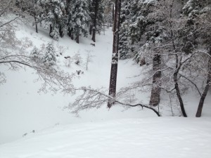
Yes we did get some snow in the snowplay areas about 2 “.  I was up in the areas this morning.  It is very pretty with the new snow.  It is a bit thin for sledding but I did see some people sledding.

12-12-15

Always make sure you carry chains that fit your car and that you know how to install them. Only play in the snow on Public lands, (stop to see us at Mountain Hardware and  we can provide you with a map and info where the best conditions are currently). Please respect private property and do not play there.   You will also need an Adventure Pass $5.00 per day or $30.00 for a year we can supply that for you. Please remember to always pick up and take home any trash as this will make it nicer for the next visitor.

If you have any questions, please feel free to call us at Mountain Hardware 760-249-3653 Mon – Sat 8:30am-5:30pm and Sunday 8:30am-4:30pm. We are located at 1390 Hwy #2 in Wrightwood on the north side of the highway and have a large parking area and restrooms


El Nino in the San Gabriel Mountains, 2004-2005

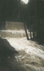
Here's a view of the first Winter Creek check dam upstream from Roberts' Camp. Note the stair-step appearance of the inundated check dam. The larger dam's footing is protected by the smaller sill dam in the foreground. In the great 1969 Flood, also an El Nino year, all the dams in the main Big Santa Anita Canyon, downstream from the confluence of the North Fork, lost their sill dams in just one evening. Sadly, ten cabins also washed away.

Here’s a view of the first Winter Creek check dam upstream from Roberts’ Camp. Note the stair-step appearance of the inundated check dam. The larger dam’s footing is protected by the smaller sill dam in the foreground. In the great 1969 Flood, also an El Nino year, all the dams in the main Big Santa Anita Canyon, downstream from the confluence of the North Fork, lost their sill dams in just one evening. Sadly, ten cabins also washed away.

Here are some photos I took of the Big Santa Anita Canyon ten years ago when Southern California experienced its’ last significant El Nino fall & winter.  Wrightwood & the Big Santa

Our hiking trail (Gabrielino) washed out at this bend in the canyon between Cascade picnic area and Sturtevant Camp. The painstaking process of building a low wall for fill sand has just begun. My wife Joanie & I were running Sturtevant's at the time. Our rain gauge had recorded over 90" before the season was through! Opid's Camp, in the West Fork of the San Gabriel River, recorded over 110" that same winter.

Our hiking trail (Gabrielino) washed out at this bend in the canyon between Cascade picnic area and Sturtevant Camp. The painstaking process of building a low wall for fill sand has just begun. My wife Joanie & I were running Sturtevant’s at the time. Our rain gauge had recorded over 90″ before the season was through! Opid’s Camp, in the West Fork of the San Gabriel River, recorded over 110″ that same winter.

Anita are about 25 air miles apart from one another.  It’s possible to hike (approx. 75 miles)  between Wrightwood and where these winter images were taken out

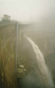
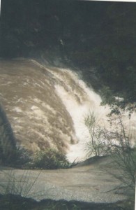
This is a scene of the Big Santa Anita Canyon Dam, located just north of Arcadia, at maximum spill way. Over 1,700 cubic feet of water per second was running through and over the dam the day this photo was taken.

This is a scene of the Big Santa Anita Canyon Dam, located just north of Arcadia, at maximum spill way. Over 1,700 cubic feet of water per second was running through and over the dam the day this photo was taken.

in the Angeles National Forest’s “front country.”  What the two places share, of course, are the San Gabriel Mountains!

When warmish Pacific Ocean storms come in off the coast, it’s the front country that faces the San Gabriel Valley and Los Angeles Basin, that really gets slammed.  You might say that our mountain rain is a text

book example of the orographic phenomena experienced on immeasurable mountain slopes.  If the base of the mountain, L.A. for example, receives an inch of rain, 2000′ upslope you

might receive over two to three inches out of the same storm. The mountainous geography wrings out the clouds as you keep climbing up in elevation.  As a rule, Wrightwood receives about a third of what the front country slopes might

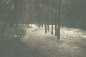
Here's a scene looking up canyon, near Roberts' Camp, Big Santa Anita Canyon. Note the two cabins in the background. These dark trees standing in the tumultuous water are white alders. It is here that I decided to turn around and not continue up canyon. The stream becomes a wall-to-wall situation not too far ahead.

Here’s a scene looking up canyon, near Roberts’ Camp, Big Santa Anita Canyon. Note the two cabins in the background. These dark trees standing in the tumultuous water are white alders. It is here that I decided to turn around and not continue up canyon. The stream becomes a wall-to-wall situation not too far ahead.


get.  When it’s summer time, however, our proximity to the Mojave Desert provides us with thunder storms that the front country can only dream about.  So both sides of the San Gabriels have their give and take when it comes to wet weather.

Big Santa Anita Canyon is not a large watershed at all, say in comparison to the San Gabriel

Looking back at the stream as it's about to roll over the top of a check dam. These "check dams" were built throughout many of the Angeles' front-country canyons back in the late 1950's through the late 60's.

Looking back at the stream as it’s about to roll over the top of a check dam. These “check dams” were built throughout many of the Angeles’ front-country canyons back in the late 1950’s through the late 60’s.

River.  Yet, it’s miles of steep terrain can become saturated after days of relentless rainfall.  Generally, the “canyon” can take upwards of a dozen inches of rain over several days before the stream comes up appreciably.  The El Nino storm systems of 2004-2005 sometimes came in one after another, barely allowing more than a half day of blue sky and no time for the moisture to percolate down through the fractured rocky slopes.   These photos show what a front-country stream can become after multiple storms come through, one after another.  What they can’t convey, is the deafening sound, so loud in some cases that it’s impossible to yell across a stream this size and be heard.   When in a little cabin alongside a roaring stream like this one, it’s possible at night, to feel and hear the impact of shifting boulders, jarring up against each other in the dark froth. Scent is a also a highlight of canyons in flood stage.  Organics

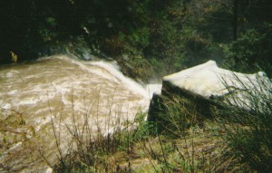
This is how high the streams in the front country can become during a heavy rain season. What you're looking at is a check dam, approximately 50' across in width. This kind of water is nothing to tangle with.

This is how high the streams in the front country can become during a heavy rain season. What you’re looking at is a check dam, approximately 50′ across in width. This kind of water is nothing to tangle with.

locked away in loamy soils along stream banks for years and years are suddenly released.  There’s this olfactory collage of crushed and soaked bay leaves, oak leaves, decomposing vegetation and grinding rock that are seldom experienced in drier times.

by  Chris Kasten

This poem by W.S. Merwin, entitled “Rain Travel”, seems to encapsulate the nocturnal in watery canyons, like the Big Santa Anita, during times like these.

“I wake in the dark and remember it is the morning when I must start by myself on the journey.  I lie listening to the black hour before dawn and you are still asleep beside me while around us the trees full of night lean hushed in their dream that bears us up asleep and awake.  Then I hear drops falling one by one into the sightless leaves and I do not know when they began but all at once there is no sound but rain and the stream below us roaring away in the rushing darkness”.

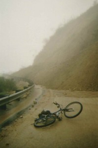
Here's my bike in front of a slide that covered the road while I was photographing the Big Santa Anita during flood stage. Fortunately, my truck was sitting in a friend's drive way in north Arcadia. A number of Forest Service employees had vehicles trapped on the upper end of this and other slides for nearly 10 months!

Here’s my bike in front of a slide that covered the road while I was photographing the Big Santa Anita during flood stage. Fortunately, my truck was sitting in a friend’s drive way in north Arcadia. A number of Forest Service employees had vehicles trapped on the upper end of this and other slides for nearly 10 months!

Big Horn Mine Trail Recently Damaged by Rains

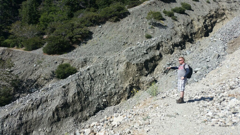
A hiker ponders his next move.  The torrential rains from earlier this month have ripped a sizable gash through the mine trail just a short distance in from Vincent Gap.       photo courtesy:  Dave Vasquez, Mountain Hardware.

This hiker ponders his next move. The torrential rains from earlier this month have ripped a sizable gash through the mine trail just a short distance in from Vincent Gap.
photo courtesy: Dave Vasquez, Mountain Hardware.

The trail to the Big Horn Mine was recently washed out by the heavy thunderstorms experienced throughout the San Gabriel mountains.  Earlier this month, our gauge received 4.03″ in a just a few hours, turning Wrightwood’s Swarthout wash into a raging torrent.  Erosion occurred throughout  the community and on local mountain hiking trails as well.  Take care crossing this drop-off if you happen to be planning a hike to the Big Horn mine.

by Chris Kasten

Two Summer Hikes to the Big Horn Mine and Mt. Baden-Powell

BIG HORN MINE

Total Trip Length =  3.6 miles round trip

Elevation Gain     =  500 feet

Trailhead Location:  Vincent Gap on the Angeles Crest Highway
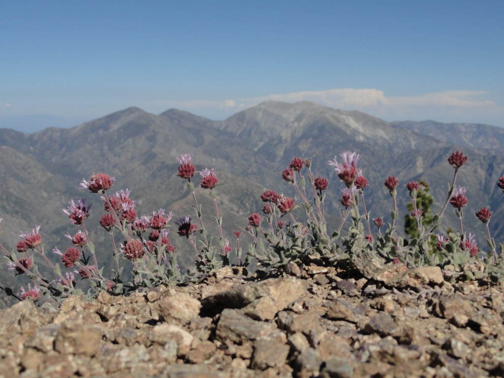
This grouping of alpine wildflowers softens the sharpness of Mt. Baden-Powell's north ridge while nearing the summit.  Pine Mountain, Dawson Peak and Mount Baldy make up the skyline.

This grouping of alpine wildflowers softens the sharpness of Mt. Baden-Powell’s north ridge while nearing the summit. Pine Mountain, Dawson Peak and Mount Baldy make up the skyline.

When it’s hot and sweltering in the front-country of the San Gabriel mountains, taking your next hike to Mt. Baden-Powell, located in the high-country near Wrightwood, just might be a good way to go.  The views are spectacular and far-reaching under deep blue skies.   There are few places where you’ll encounter such a variety of conifers.    Earlier this summer, my wife and I hiked out to the abandoned Big Horn Mine.  A couple of miles of hiking along a dilapidated dirt
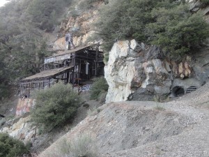
View of stamp mill and adit (horizontal mine shaft) clinging precariously to slope of Mine Gulch on Mt. Baden-Powell.

View of stamp mill and adit (horizontal mine shaft) clinging precariously to slope of Mine Gulch on Mt. Baden-Powell.

road that skirts the steep and, at times,  forested mountainside of Mt. Baden-Powell, takes you to this historic relic of the earlier days of mining in the East Fork of the San Gabriels.  The mine’s location was found by the back-country recluse and mountain man, Tom Vincent, back in 1895 while out hunting for big horn sheep.   Various groups of investors and entrepreneurs each took their chances at developing the remote mountainside mine from the turn of the century up until the early 90’s.  In all cases through out the decades, investment exceeded the value of the extracted gold, followed by diminishing returns until abandonment.
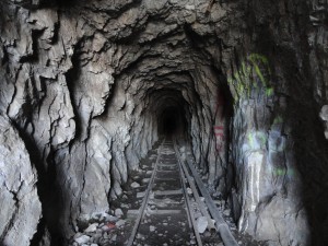
This narrow track that once carried ore cars is still looking pretty good.  The Big Horn Mine is comprised of both horizontal and vertical shafts.

This narrow track that once carried ore cars is still looking pretty good. The Big Horn Mine is comprised of both horizontal and vertical shafts.

This pattern of running the mine for a some time, only to be followed by quiet idle years, has continued for over a century.   Today the disintegrating  remains and cool, empty tunnels sit quietly in the steep, rugged slopes of Mine Gulch at about 7,000′ in elevation.

To get to the mine’s trailhead, park at Vincent Gap on the Angeles Crest Highway, just west of Wrightwood, CA.   Pass by the white pipe gate, continuing along the red, rutted old mine road.  As you skirt alongside the mountainside, watch for a hiking trail switchbacking down into the Sheep Mountain Wilderness Area of Vincent Gulch and on into the expansive East Fork of the San Gabriel watershed.  Pass by the trail turn-off, staying with the road as it skirts alongside a steep mountain chute,
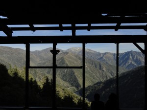
Mt. Baldy and Iron Mountain as seen from within the steel framing of the Big Horn Mine's stamp mill.

Mt. Baldy and Iron Mountain as seen from within the steel framing of the Big Horn Mine’s stamp mill.

then enters into a soft and forested slope of mature sugar pine, white fir and the ever-present aromatic jeffrey pines.   Eventually, you’ll leave the protection of the forested slope and enter back into steep and arid mountainsides of fractured rock, peppered with yucca, manzanita and mountain mahogany where these plants can get a toehold.    In places, the road can be completely washed out, necessitating scrambling alongside narrow and crumbling scratch trails made by other hikers.  The exposure and consequence of a misstep is a reality along this side of Mt. Baden-Powell, so take your time.  For the most part, the hiking is fairly easy for good stretches, eventually taking you around a shoulder on the mountain to the Big Horn’s rusted out stamp mill and other assorted mining debris, pipe and concrete slabs.

The adits, horizontal mine entrances, are fenced off with steel bars; the last owner’s attempt to keep hikers from going into the mountainside.  When you get to the end of the road, be careful crossing the steep slope over to the stamp mill.  Return the way you came.

MOUNT BADEN-POWELL

Total Trip Length = 7.6 miles round trip

Elevation Gain     =  2,800 feet

Trailhead Location:  Vincent Gap on the Angeles Crest Highway

Mt. Baden-Powell, once known as North Mt. Baldy, was re-named for Lord Baden-Powell, founder of Boy Scouting in the United States.   The approach to this 9,399′ peak is by way of the pleasantly forested north-east facing mountainside, affording you ample shade and stunning views out over the Mojave Desert and eastern high country of the San Gabriels.
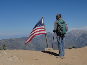
Joanie Kasten stands at Mt. Baden-Powell's summit.  Pine Mountain and Mt. Baldy make up the backdrop as Old Glory flies in a brisk mid-summer breeze.

Joanie Kasten stands at Mt. Baden-Powell’s summit. Pine Mountain and Mt. Baldy make up the backdrop as Old Glory flies in a brisk mid-summer breeze.

You’ll want to dedicate most of your day to this hike due to the high elevation of the summit and also some of the steep trail pitches between the 37 switchbacks.  Bring plenty of water for each person in your group, i.e.  two to three liters.  Avoid taking this hike in the winter and early spring months due to steep, icy slopes that parallel this route.  When there’s ice, the potential for a fatal accident is ever-present.  During the warmer months, this well maintained trail is a wonderful route to the top and quite safe.

Head on up the red, dusty path alongside the split cedar fence.  Scrub oak, white fir and jeffrey pines shade your route as you head toward the
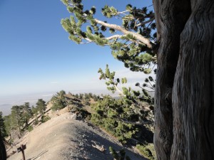
A view from part way up a limber pine.  Looking toward the north, you can make out the faint outline of the Pacific Crest Trail, PCT, as it parallels the left hand side of the ridge.   Note the trail junction sign, where the trail continues on toward the west passing by Mt. Burnham, Throop Peak, Islip Saddle and on along the spine of the San Gabriel mountains.  2,200 miles further, the PCT terminates in British Columbia, Canada.

A view from part way up a limber pine. Looking toward the north, you can make out the faint outline of the Pacific Crest Trail, PCT, as it parallels the left hand side of the ridge. Note the trail junction sign, where the trail continues on toward the west passing by Mt. Burnham, Throop Peak, Islip Saddle and on along the spine of the San Gabriel mountains. 2,200 miles further, the PCT terminates in British Columbia, Canada.

first of many switchbacks.  The trail switches back and forth along the broad, northeast facing ridge line of the mountain.  Each time the trail wraps back around the ridge, for quite a ways up, you can look back down at the Vincent Gap trailhead parking area, possibly even spotting your car.  Four switchbacks up is a nice little wooden bench to rest on.  By now, you can begin to gauge your progress, by sighting out across to West Blue Ridge, gradually gaining a greater view out into the Mojave desert’s vastness.   Old, magnificent sugar pines begin to make their presence as you continue climbing up; their long horizontal branches terminating in clusters of long cones that exude bright, shiny sap.  A large cool, flat slab of rock is up this way, too.  The mountains internal coolness is often evident when laying up against this monolith.
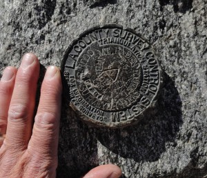
This benchmark attests to Mt. Baden-Powell's former namesake, North Mt. Baldy.   Affixed to a boulder at the summit, it marks the high point (9,399' elevation) of your day.

This benchmark attests to Mt. Baden-Powell’s former namesake, North Mt. Baldy. Affixed to a boulder at the summit, it marks the high point (9,399′ elevation) of your day.

Almost half-way up, a wooden sign at the end of a switchback points the way to  Lamel Spring, which makes for a tranquilly floral spot to take a rest.  The switchbacks become ever broader from here, passing by inviting little flats filled with pools of shade and quiet sunlight where people have camped amongst the scented evergreens, perhaps taking in the glow of sunrises and sunsets not to be forgotten.  A bit further on, the switchbacks begin to tighten up, as does the steepness.  Lodgepole pines are now becoming the the dominant conifer, as you’re squarely into the 8,000′ + elevation range.  The bare forest floor is in places littered with their tiny ornate cones.  Glades of low buckbrush and deer brush fill in empty pockets where the perfectly straight lodge poles have left a little sunlight.  On and on you keep climbing while converging ridges begin to make their way toward you and the ever-nearing summit.  And then it happens – twisted and wind bent limber pines finally appear.  At this point you’re nearly
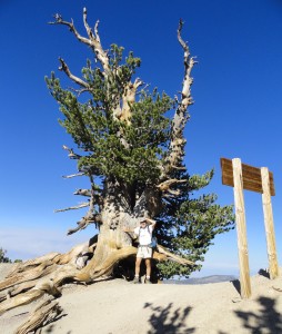
The author takes a break at the base of a wind-sculpted limber pine near the summit of Mt. Baden-Powell, San Gabriel mountains, CA.   At this elevation of 9,300', the sky appears to be nearly cobalt blue.

The author takes a break at the base of a wind-sculpted limber pine near the summit of Mt. Baden-Powell, San Gabriel mountains, CA. At this elevation of 9,300′, the sky appears to be nearly cobalt blue.

9,000′ up and there’s a spaciousness between these ancient trees that in many cases are nearly as wide as they’re tall.  The lines of the sun burnished wood of these rare trees appear twisted and deeply etched by centuries of sun, wind and ice.  Not much further up, the switchbacks finally give out and you find yourself hiking atop a narrow ridge with a dizzying drop-off into the East Fork thousands of feet below to your left.  Fortunately, the trail is just a few feet over on the gentler, west side of the ridge.  Near the end of this airy ridge, there’s a tree near the Pacific Crest Trail cut-off and the final summit approach which is worth pondering.    A weathered, wooden sign indicates that this limber pine is over 1,500 years old!  There are other trees in the area that are reputed to be over 2,500…., yet remain unmarked to keep them protected.
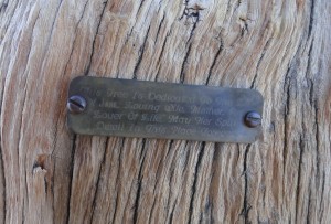
A weathered brass tag honors the memory of a loved one.   It was placed some years ago up on a limber pine, high atop Mt. Baden-Powell.

A weathered brass tag honors the memory of a loved one. It was placed some years ago up on a limber pine, high atop Mt. Baden-Powell.

Soon you’re on top of the mountain.  The top is rounded and exposed.   A four-sided concrete and brass edifice to scouting, its’ base eroding,  is near the top , along with an uncovered trail register with hundred of entries of hikers who made the climb.  Look off in any direction and the view’s good.  On clear, wind-swept days, you can make out distant peaks like Mt. Wilson and even the channel islands.  Myriads of canyons drop off all around.  Enjoy the return trip back.
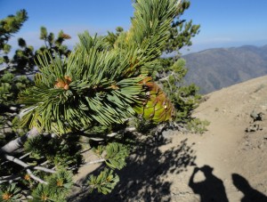
Here's a close-up of needles and accompanying cone on a limber pine, Mt. Baden-Powell, San Gabriel mountains, CA.   Short needles are sheathed in clusters of five.  The clusters of needles are concentrated at the ends of cord-like branches which withstand the very high winds that occur high on the mountainside.

Here’s a close-up of needles and accompanying cone on a limber pine, Mt. Baden-Powell, San Gabriel mountains, CA. Short needles are sheathed in clusters of five. The clusters of needles are concentrated at the ends of cord-like branches which withstand the very high winds that occur high on the mountainside.

by Chris Kasten


Hike to Lamel Springs, Mount Baden-Powell

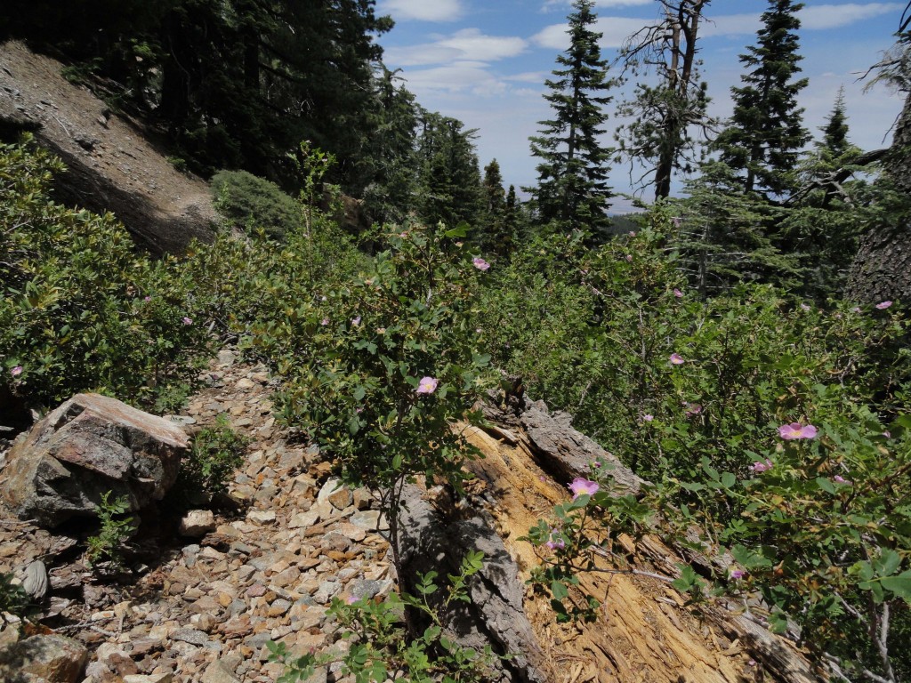
Wild California roses adorn Lamel Spring on Mt. Baden-Powell.  This sunny scene is looking north toward the Mojave Desert at an elevation of approx. 7,600'.

Wild California roses adorn Lamel Spring on Mt. Baden-Powell. This sunny scene is looking north toward the Mojave Desert at an elevation of approx. 7,600′.

Total trip length = approx. 3 1/2 miles round trip

Elevation gain    = 1,100′

Trailhead location:  Vincent Gap on the Angeles Crest Highway

This hike ascends the switch-backing Pacific Crest trail up the northeast facing slope of Mt. Baden-Powell.  This is an easy to moderate hike, affording scenic vistas out over the Mojave Desert and the eastern high country of the San Gabriel mountains.

This shooting star is another delicate alpine beauty found in the environs of Lamel Spring.

This shooting star is another delicate alpine beauty found in the environs of Lamel Spring.

Just recently, with summer edging toward the beginning of July, I hiked up to the little mountainside oasis of Lamel Spring on the forested slope of Mount Baden Powell.   Somehow, it seems that on every trip back to this beautiful mountain, that the experience is somehow brand new.  As with all hikes starting out from Vincent Gap, the soil is brick red and dusty, a bit like being out in parts of New Mexico and Utah.    The trail wastes no time in its’ ascent up the northeast facing slopes of the mountain.  Many of the hikers starting out from Vincent Gap have one goal in mind;  summiting the 9,400′ peak and then returning down the same trail.   If you don’t feel like going all the way to the top, this little spring is a peaceful and scenic destination located a little less than half way up to the top.

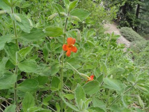
Scarlet monkey flowers abound on the slope of Lamel Spring.

Scarlet monkey flowers abound on the slope of Lamel Spring, less than halfway up to the summit.

There are fifteen switchbacks in the 1 3/4 miles to the spring.   Forest transition is ever-present as you continue to climb up and along the slopes.  In the beginning of the hike, you’re amongst tenacious scrub oaks mingling amongst the ever-present Jeffrey pines.  It’s not long until white fir begin to make their presence and the oaks disappear.  A bit further up, noble stands of ponderosa and sugar pine begin to dominate the scene.  While all this is happening, the sky at this elevation, most days, takes on a cobalt blue look to it.  The air is fragrant with the intermingling of conifers, somehow peaking the senses.  Look for a little bench about halfway to the spring.  It’s out on the end of a switchback, presenting you with a view back down to where you left your car!   This is a good

A small standing pool of water is all that remains of Lamel Spring on this early summer day.  This spot is beyond valuable to local wildlife.

A small standing pool of water is all that remains of Lamel Spring on this early summer day. This spot is beyond valuable to local wildlife.

place to rest and take in the scenery.  To the east, you can view East Blue Ridge and the top of the lift for Mountain High Ski Resort.  Looking straight across the great openness of the East Fork of the San Gabriel River, Pine Mountain and Mt. Baldy present themselves in stark relief against the horizon.

When you come to the sign for Lamel Spring, just head to your left and follow the narrow path for a couple of hundred yards.  Even from the spring, if you look carefully, it’s possible to see the trailhead parking area.  Enjoy the peace of this place and take your time on the return hike back.  Springs like this are a rare find in the San Gabriels!


by Chris Kasten


East Fork of the San Gabriel River – Hiking Down Stream from Mine Gulch Camp

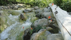
This columbine flower graces the tumbling stream of the Upper East Fork of the San Gabriel River.

This columbine flower graces the tumbling stream of the Upper East Fork of the San Gabriel River.

Total trip length =  approx. 12 miles round trip

Elevation loss     =  2,700′.  This hike is all downhill until you turn back around for the return

Trailhead location:  Vincent Gap on the Angeles Crest Highway,  just west of Wrightwood

This hike descends Vincent Gulch to Mine Gulch campsite, then further down East Fork

Last Wednesday I journeyed back down Vincent Gulch to the stream side shelf of Mine Gulch Camp.  Nothing’s at Mine Gulch any more in the way of improvements such as tables, fire pits or outhouses.  However, the broad bench alongside the stream bed is shady  and very level, offering a great camping spot at a place where you can explore the Prairie Fork by going straight across the wide, bouldery wash or heading down the East Fork toward Alder Gulch, Fish Fork and points further on.  My goal was to continue down the East Fork of the San Gabriel River to a spot near the confluence of Alder Gulch and then double back, hopefully returning back up to Vincent Gap before I lost my light.

Heading down the trail in Vincent Gulch toward Mine Gulch campsite.

Heading down the trail in Vincent Gulch toward Mine Gulch campsite.

Really, once you starting heading downstream from Mine Gulch campsite, the East Fork stream bed is one big rocky floodplain for the next thirteen or fourteen miles to road’s end  near Follow’s Camp.  It is slow going and the stream crossings are numerous.  Bring a pair of water shoes with you, so you can just slog across the East Fork without having to make an endless number of risky jumps just to keep your boots dry.

Iron Mountain as seen from the East Fork of the San Gabriel River, just downstream from Mine Gulch campsite.

Iron Mountain as seen from the East Fork of the San Gabriel River, just downstream from Mine Gulch campsite.

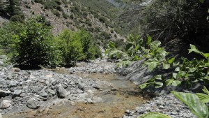
Part of the character of these upper reaches of the East Fork is the isolation from other hikers.  I was out for nine hours and only saw one person, and that one person was within a hundred yards of the trailhead at Vincent Gulch.  That was it!  Much of the terrain passes through a myriad of beautifully striped metamorphic boulders, piles of fractured rocks that have fallen hundreds of feet from towering cliffs that border the deep canyon.  You must pick your stream crossings amongst wide glades of buckwheat, Yerba Santa and mountain mahogany peppered with sunbaked driftwood from times and storms gone past.

Looking downstream, near the confluence of Mine Gulch and the main canyon of the East Fork of the San Gabriel River.

Looking downstream, near the confluence of Mine Gulch and the main canyon of the East Fork of the San Gabriel River.

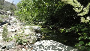
Gentle, onshore breezes pushed up canyon as I continued heading downstream.  Occasionally,  beautifully twisting sycamores graced my way, sheltering me from the relentless June sunshine.  Their leaves quaked gently back and forth in the fresh air.  The interplay of shadow and bright pools of warm light constantly and quietly changed the mood around every bend in the canyon.  Surprisingly, the stream was flowing much more abundantly than I had expected.  Narrow hedgerows of white alder grew tightly along most of the stream course, adding their shade across secret pools of green.

A tranquil setting of white alders alongside the East Fork of the San Gabriel River. Near confluence of Alder Gulch.

After finally turning around for the long ascent back to the car, I had fun looking for stacked rock cairns, “ducks”,  that had been placed by earlier hikers to mark where they thought the route should be amongst the wide, wide sunbaked washes.   It was a tiring, yet exhilerating day in the wild and quiet Sheep Mountain Wilderness.  If you want to get re-charged with the peace and quiet of the open spaces of our mountains, this just might be the place to consider.

by Chris Kasten
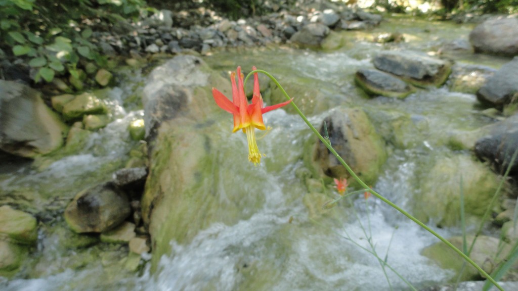
This clump of columbine has found its' niche in the center of the stream bed.

This clump of columbine has found its’ niche in the center of the stream bed.

Hiking on to Lupine, Guffy and Acorn Canyon, Wrightwood

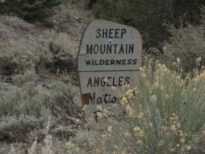
A weathered Forest Service boundary sign denotes the edge of the Sheep Mountain Wilderness in the Prairie Fork up canyon from Lupine Campground.  Both Lupine and Cabin Flat Campgrounds are just outside the boundary.

A weathered Forest Service boundary sign denotes the edge of the Sheep Mountain Wilderness in the Prairie Fork up canyon from Lupine Campground. Both Lupine and Cabin Flat Campgrounds are just outside the boundary.

Once I left Cabin Flat’s abandoned remains, the road steadily and steeply made its’ way up the Prairie Fork.  A Dwight Twiley song, “I’m On Fire” (circa 1975), kept running through my head as my route passed through thick groves of buckbrush and sage intermingled with groves of statuesque Jeffrey and Ponderosa pines.  Nature had made good on her promise to take back what people had not maintained.  The road is designated as 3N39 and is wide enough to drive on for short distances, only to be reduced to single track and even completely missing at a couple of

The old Prairie Fork Road as seen just upstream from Cabin Flat Campground.

The old Prairie Fork Road as seen just upstream from Cabin Flat Campground.

stream bed crossings.  The Prairie Fork is in many ways a wide flood plain throughout her length.  Left and right and left, again,  the channel meanders where it will and so do my thoughts.  The metamorphic boulders’ grays seemed ever grayer under the flat steel gray skies on my upward trek.  Yet, there was a brightness that came flooding in every so often throughout the quiet alpine day.  The air continued to be still and fresh.  Small bird calls and the crunching of my boots on dry twigs and sand punctuated the quiet scenery.  Several miles up from Cabin Flat I encountered the sylvan, forested bench of Lupine Campground.  The elevation between the two camps is about 1,200′, yet enough to produce a noticeable change away from the oak-woodland environment into a mature coniferous forest.

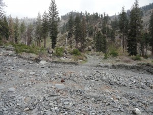
A washed out streamed crossing just down canyon from Lupine Campground in the Prairie Fork.

A washed out streamed crossing just down canyon from Lupine Campground in the Prairie Fork.

True to its’ name, the resilient purple and lavender blooms of lupine abound in this forest setting.  As with Cabin Flat, there were no people here at Lupine Campground, either.   The tables here are the “old style” large dimensional type built by the Forest Service back in the day.  Liking them so much, I once copy-catted this design, including the hefty 3″x12″ planks, and built some at Sturtevant Camp in the Big Santa Anita Canyon.   There’s the sense of being in a bit of a time capsule in places like this.  Over and over, I saw the rock work which used to support the flat plate Klamath style wood burning stoves that each campsite once had. It was amazing how “at home” I felt here in this old hidden camp.  One issue, however, kept knocking at the back of my throat…  My water was nearly out and the Prairie Fork had been reduced to a dry wash not far above Cabin Flat.  If only Columbine

A peaceful campsite as scene here at Lupine Campground in the Prairie Fork.  Located at 6,500' elevation, this forested destination is replete with 12 campsites and nearby Columbine Spring.   It is also the 'jumping-off' point for hikes into the Fish Fork.  Take forest service road 3N39 to access this site.

A peaceful campsite as scene here at Lupine Campground in the Prairie Fork. Located at 6,500′ elevation, this forested destination is replete with 12 campsites and nearby Columbine Spring. It is also the ‘jumping-off’ point for hikes into the Fish Fork. Take forest service road 3N39 to access this site.

Spring was running…  Time to check it out.

The scuffing of my boots through the sagebrush woke up the sleepy scent and my thoughts would be filled with more mountain places.  Up the little canyon behind the camp I followed the broken pipes of the derelict water system.  Climbing the upslope wall of the concrete water tank, I peered down into the opening in the roof.  It was dry and filled with rocks.  So, onward and upward I went, passing squaw currant and more sage.  Eventually meeting up with the Fish Fork Trail, the little canyon

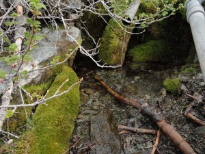
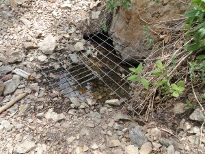
Columbine Spring above Lupine Campground in the Prairie Fork.   Accessing this water made all the difference in getting back home to Wrightwood.  Note the pipe sections from the abandoned water system that once served Lupine Campground.  This spot can be accessed by walking up the Fish Fork Trail just up canyon from the camp.

Columbine Spring above Lupine Campground in the Prairie Fork. Accessing this water made all the difference in getting back home to Wrightwood. Note the pipe sections from the abandoned water system that once served Lupine Campground. This spot can be accessed by walking up the Fish Fork Trail just up canyon from the camp.

produced the sweetest little sound of trickling water over rocks and mosses.  Setting up to filter some of this mountain spring water, a pair of hummingbirds buzzed my red anorak jacket and then went about their work of gently prodding what nectar they could get from the still developing blooms of the currant.  They seemed to keep a wary eye on this lone traveler as the three of us took what we could from the oasis.

Happily rehydrated, it was time to get a move-on up and out of the Prairie Fork to Guffy Campground.  Munching on almonds and a little apple, I encountered a third washout on the road dropping down from Blue Ridge.  High clouds were swarming past Pine Mountain, now looming high up to the southeast.  Occasional spits of rain had now turned to sleet and hail.  Putting on my rain gear under a cluster of oaks alongside the switchbacking road, the chill was now beginning to soak in.  The only thing to do was hike faster, and, of course, I was soon sweating under the rain top.  Sunshine

came streaming in as the pelting of hail resonated under my hood.  Puddles had formed and red

The Fish Fork Trail near its' trailhead at Lupine Campground.  This section of trail was originally a narrow road that one could drive on to West Pine Mountain Ridge.  I drove this road back in the early 1980's.  Today it is all single track, non-motorized trail.

The Fish Fork Trail near its’ trailhead at Lupine Campground. This section of trail was originally a narrow road that one could drive on to West Pine Mountain Ridge. I drove this road back in the early 1980’s. Today it is all single track, non-motorized trail.

bouquets of Indian Paintbrush speckled the glistening slopes of rock, pine and sage.  A thick blanket of clouds had now pushed up so high, Pine Mountain’s (9,648′ elevation)  plate-like slide was completely hidden from view.  As soon as I reached the top of the road, the moisture was over, replaced with a frigid breeze.

Guffy Campground, like its’ neighboring camps, was devoid of people.  Although chilly, a warm light permeated the late day scene.  Dropping down to the north side of the campground to find the spring just barely flowing, really more of a drip, at this point in the year, filled me with fiery summertime woes.

Road junction for the descent into Prairie Fork from East Blue Ridge.  Photo taken just past (east) Guffy Campground.

Road junction for the descent into Prairie Fork from East Blue Ridge. Photo taken just past (east) Guffy Campground.

Heading east on the Pacific Crest Trail, the gold light illuminated the ancient “flag” trees growing out of Blue Ridge’s gentle and meandering rocky trace.   A yellowed little poem from the Mountaineer Progress Newspaper, that lays on my desk, came to mind.  There is no author attached to this little beauty, except the words: “Thanks Blue Ridge, Holiday Hill and Table Mountain.”

Where is the magic?

Pristine, shimmering snow

Slopes no prints have crossed

Breathtaking view

And peace, utter peace.

What is the magic?

About a mountain mantled with fires.

Arms reaching to the heavens while we traverse snowy paths.

Can there be magic?

In loving my Blue Ridge, schist clad bare faces

Paths skirted by buck brush offering redemption and renewal.

I once felt the magic of her sensuous slopes shining beneath my long skis

Offering of herself

Assuring the restoration of my soul.

Once, down the Acorn Trail a few hundred feet, the temps seemed to have bumped up a good 15 to

Late afternoon view of Guffy Campground.  At 8,300' elevation, this is the highest "drive-in" camp in the Angeles National Forest.

Late afternoon view of Guffy Campground. At 8,300′ elevation, this is the highest “drive-in” camp in the Angeles National Forest.

20 degrees.  Finally.  Dusk was rapidly falling on the north side of Blue Ridge as the trail made its’ rapid descent of 1,500′ down into Acorn Canyon.  The Swarthout Valley cradled Wrightwood, far below, in a story book dream.  The yawning had begun. Too lazy to walk the entire distance home, I called my wife from the mountainside to see if I could get a short ride home from the trailhead.  Just before Joanie met up with me, the walk past large homes, lit from within, was almost over whelminging reminiscent of how a

The situation looks bleak at the little spring situated downslope and north of Guffy Campground.   This spot can be accessed by walking steeply down a north-facing path that drops into a draw below the campground.  The old pump house is your landmark.

The situation looks bleak at the little spring situated downslope and north of Guffy Campground. This spot can be accessed by walking steeply down a north-facing path that drops into a draw below the campground. The old pump house is your landmark.

lone traveler sees everything from the outside.  Truly separated from another’s hearth fire.  For a few moments the wildness of the day seemed to not know how to marry with the world of seemingly big, quiet houses and pavement.  When

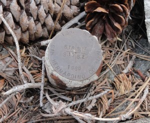
A range and township benchmark located alongside the Acorn Trail, just below the Pacific Crest Trail.  This "monument" shows that you are at the point where sections 17,18, 19 and 20's four corners come together south of Wrightwood, CA.  This spot is marked on the Mt. San Antonio 7.5' topographic quadrangle.

A range and township benchmark located alongside the Acorn Trail, just below the Pacific Crest Trail. This “monument” shows that you are at the point where sections 17,18, 19 and 20’s four corners come together south of Wrightwood, CA. This spot is marked on the Mt. San Antonio 7.5′ topographic quadrangle offering the map reader a “sense of place.”

the little car pulled up to greet me, the scent of home-made lasagna wafted up from her hair and clothes.  Ever better, comfort of home had arrived to me.  I was back home as a traveler from the near, yet distant lands of our mountains.

by Chris Kasten
 

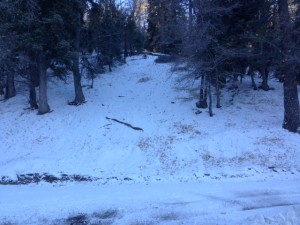
5/15/15

photo 5-15-15We have SNOW!!!!!!!!!!!

We have about 2-3 inches in the snow play areas this morning.  I just came back from the snow play areas and the picture was taken this morning at about 9am. Click on the picture for a larger view.

The conditions look good.  Roads are open with no controls. The temp this morning was in the mid to upper thirty’s.

So come on up and get some Snow play in May in Southern California.

Should not be any crowded.

Always make sure you carry chains that fit your car and that you know how to install them. Only play in the snow on Public lands, (stop to see us at Mountain Hardware and  we can provide you with a map and info where the best conditions are currently). Please respect private property and do not play there.   You will also need an Adventure Pass $5.00 per day or $30.00 for a year we can supply that for you. Please remember to always pick up and take home any trash as this will make it nicer for the next visitor.

If you have any questions, please feel free to call us at Mountain Hardware 760-249-3653 Mon – Sat 8:30am-5:30pm and Sunday 8:30am-4:30pm. We are located at 1390 Hwy #2 in Wrightwood on the north side of the highway and have a large parking area and restrooms

Mike

Hike to Vincent Gap – Mine Gulch – Prairie Fork – Cabin Flat

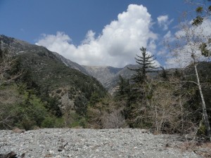
Viewing Mt. Baden-Powell from confluence of Mine Gulch, Vincent Gulch and the Prairie Fork.

Viewing Mt. Baden-Powell from confluence of Mine Gulch, Vincent Gulch and the Prairie Fork.

Just last week, on Earth Day, I hiked down the Mine Gulch Trail from the Vincent Gap trailhead.

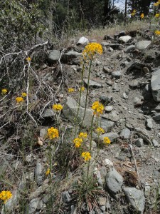
Common wall flowers alongside the upper Mine Gulch trail.

Common wall flowers alongside the upper Mine Gulch trail.

My goal was to reach dilapidated Cabin Flat Campground, up in the Prairie Fork.  This would be an

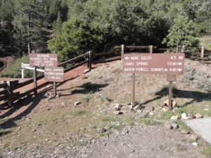
Vincent Gap Trailhead.  The approach to Big Horn mine, Mine Gulch and the greater East Fork of the San Gabriel River is past the white fire road gate to the left of the split rail fence.

Vincent Gap Trailhead. The approach to Big Horn mine, Mine Gulch and the greater East Fork of the San Gabriel River is past the white fire road gate to the left of the split rail fence.

“out and back” day hike, with the hope of returning back before dark.  Vincent Gap is a great jumping off place for everything from the Manzanita Trail down the desert side of the range, Mt. Baden-Powell’s summit, exploring the Big Horn mine or, in my case dropping into the East Fork of the San Gabriel River.  The day was still and the air crisp.  The small leaves of the ceanothus (buck brush) were tipped with the silver pearls of water droplets from the previous night’s light rain.  Looking up, only the tiniest puffs of cumulus clouds peeked out from behind Pine Mountain to the east.  Perfect.

Just below Vincent Gap (trailhead) the Vincent Gulch trail enters into a tranquil forest of Ponderosa, Sugar pine and Incense Cedar.  Squaw currant abounds on the forest floor.

Just below Vincent Gap (trailhead) the Vincent Gulch trail enters into a tranquil forest of Ponderosa, Sugar pine and Incense Cedar. Squaw currant abounds on the forest floor.

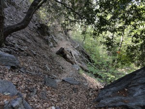
Contouring the red dirt mountainside, I followed the old Big Horn mine road to a point where the single track Vincent Gulch trail begins its’ descent.  A short ways further, the trail enters a sylvan green sanctuary of mature incense cedars and pines.  Steadily the trail descended into healthy stands of oak woodland while manzanita began to make its’ presence.  The ends of switchbacks afforded views into the expansive rocky run-outs coming off the northeast slopes of Mt. Baden-Powell.  Vincent Gulch’s steep, brushy tributaries continued to merge under canopies of canyon live oak.  Within a couple of miles, the murmur of a small stream could be made out before arriving at the bright spring greens of a healthy riparian environment of white alders and big leaf canyon maples.  The shaded stream is bounded by a steep and fractured geology.

A section of the Vincent Gulch trail travels under the shade of bays, alders and Big Cone Spruce.

A section of the Vincent Gulch trail travels under the shade of bays, alders and Big Cone Spruce.

Dark banded metamorphic rock twisted and turned, leaving the stream and trail no choice but to follow.  So, on I went through groves of laurel bay and Big Cone Spruce.  Eventually the trail gave out to a wide, barren wash of bright rocks of all size and shape.  Bright, bright sun was everywhere.  The clouds had eclipsed a bit more of the deep blue sky near both Mt. Baden-Powell’s summit and Pine Mountain as well.

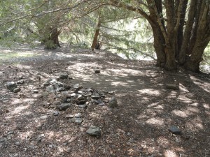
A leveled-out campsite at Mine Gulch campground.  There have been no improvements here for decades.

A leveled-out campsite at Mine Gulch campground. There have been no improvements here for decades.

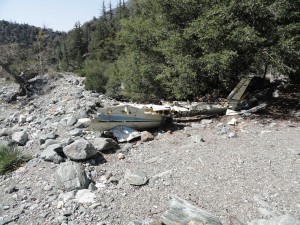
Just before approaching Mine Gulch Campground, you’ll find the wreck of a small private plane that went down many years ago.  By now I was thirsty and was half way through the water, but no problem, had thrown my water filter into the pack at the last minute.  However, had forgotten to bring a hat, and could already feel the sun beginning to burn the top of my head.

Wreckage of a light plane in lower Vincent Gulch.  This fuselage and wing sections have been here for decades.

Wreckage of a light plane in lower Vincent Gulch. This fuselage and wing sections have been here for decades.

Was soon at the Mine Gulch Campground, about 4 1/2 miles in, essentially a shelf at the confluence of Mine Gulch, Vincent Gulch and the Prairie Fork.   Back in 1978, about the only improvement at this camp was an outhouse.  Now, even that was gone.   It appeared that folks still camped here, for some of the small flats looked recently swept clean from tents and tarps.  There were some abandoned camping supplies, buckets and even a fairly new looking pick axe.  Not all that surprising.  The East Fork still attracts amateur miners looking for that elusive gold.  However, no people were to be seen or heard.  Just the constant murmuring drone of the East Fork doing its’ river thing, grinding out the mountains over the eons.

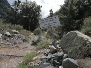
Trail sign at mouth of Prairie Fork.  Located directly across wash from Mine Gulch campground.

Trail sign at mouth of Prairie Fork. Located directly across wash from Mine Gulch campground.

Directly across the wide wash from the campground is a wooden sign telling me that Cabin Flat lays this way, not to mention the rest of the broad Prairie Fork.  Hopping from rock to rock, lizards flitted about the dry sycamore leaves.  The leaves and wash were paper dry in the way that September seems to conjure up.  It was only April…

Prairie Fork.  Just the name evokes images.  And, true to its’ name, there are places so wide that it almost beckons the name “valley.”  This is a very big drainage that has miles of timber stands, grassy meadow-like flats, chaparral and high ridge lines all around it.  Starting on up from its’ mouth, the ascent is easy, yet the trail’s about non-existent.

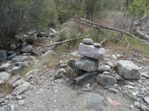
Rock cairn markers, known as "ducks" have been left by prior hikers alongside the Prairie Fork trail between Mine Gulch & Cabin Flat campgrounds.  The trail is nearly non-existent in most places.

Rock cairn markers, known as “ducks” have been left by prior hikers alongside the Prairie Fork trail between Mine Gulch & Cabin Flat campgrounds. The trail is nearly non-existent in most places.

Periodically there’d be a rock cairn or “duck”, marking the way that previous travelers had taken.  Sometimes the placement of these markers made sense, and when they didn’t, it was time re-think my next move.  The area between Mine Gulch and Cabin Flat Camps is a little better than two miles in distance and really, pretty much cross-country hiking.  The lower part of the route is made up of glades of Yerba Santa interspersed with Yucca, blossoming buckbrush and the ever-present wide wash.

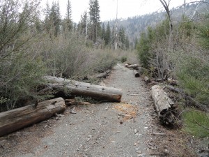
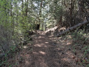
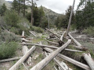
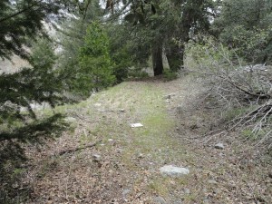
This section of the Prairie Fork trail is covered with downed trees that have been bleached by seasons of sun.  There's lots of stepping up and over downed trees, brush and boulders between Mine Gulch and  Cabin Flat campgrounds.

This section of the Prairie Fork trail is covered with downed trees that have been bleached by seasons of sun. There’s lots of stepping up and over downed trees, brush and boulders between Mine Gulch and Cabin Flat campgrounds.

Often, the pattern was following a remnant trace of trail or even the old jeep track, then coming to a turn in the canyon and being forced to cross the smallish stream.  Stream crossings in this part of the San Gabriels invariably means thrashing through thickets of young white alders.  Yet, that’s just what it is.  What really was amazing was just how very wide this canyon is.  Lots and lots of hidden terrain.  Occasionally, the canyon bottom would tighten up and so would the foliage, bringing on thoughts of fat, black rattlers just waiting under my feet…  I balanced and walked across dozens of fallen trees and the detritus of drift wood from storms in earlier times.   Just before

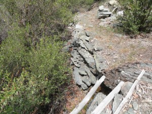
Dry stack rock wall still supports a remnant section of the Prairie Fork trail.  Photo taken just downstream from Cabin Flat campground.

Dry stack rock wall still supports a remnant section of the Prairie Fork trail. Photo taken just downstream from Cabin Flat campground.

approaching Cabin Flat, when the going seemed to be getting easy, there was a thicket of willows to pass through.  Then the young stinging nettles came into play.   Memories of having gotten stung by huge nettles back in ’78, meaning eight feet tall or more, came back sharply through the backs of my calves.  Quickly as I could, I jumped over a muddy expanse of more nettles and was free of the creek bed and climbed up the bank into an abandoned parking spur at my long awaited destination.

A small piece of the old jeep track in Prairie Fork that once went downstream to the East Fork of the San Gabriel River from Cabin Flat campground.

A small piece of the old jeep track in Prairie Fork that once went downstream to the East Fork of the San Gabriel River from Cabin Flat campground.

Completely still air and a sky that had become almost completely gray framed what was left of the old Cabin Flat Campground.   An occasional water drop made its’ way to me, yet it was the most refreshing sort of spring-like warmth mixed with the water.  The light drops seemed to wake up the scent of the sagebrush that had crept through most of the campsites that now sat idle.  Finding a few picnic tables under some shade trees, it was time to finish more of my lunch as drops turned to drizzle.  The sadness of the place had begun to soak

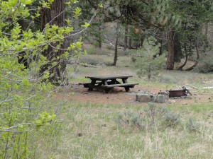
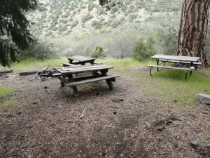
Cluster of tables and fire pit, which appear to be an actively used site at Cabin Flat campground.

Cluster of tables and fire pit, which appear to be an actively used site at Cabin Flat campground.

into me, it was time to walk off the ’70’s.  The second liter of water was now gone and this thought kept surfacing…  maybe, just maybe, I could go on further to Lupine Campground, just a few miles on.  There might even be water at Columbine Spring.  And so I walked on,

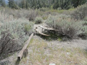
A sun-baked picnic table is taken back by encroaching Great Basin sagebrush at abandoned Cabin Flat campground.

A sun-baked picnic table is taken back by encroaching Great Basin sagebrush at abandoned Cabin Flat campground.

not heading back quite yet…

by Chris Kasten
 

4/17/15

THE HIGHWAY IS OPEN!!!!!!!!!

The Angeles Crest Highway is open.  I was just at Vincent Gap and the gates are open.  So come on up for a drive and a Great time in the Mountains.  Be carful while driving the highway as since it just opened you may see some wild game such as Bighorn Sheep, Deer, Bobcat and Mountain Lions. On my way back to the store I saw 2 deer crossing the road.  So come on up and have a great day also swing by Mtn Hardware and say hello.  Let us know how you trip was.
 

Mike